Surveyors are professionals who play a crucial role in the field of land and spatial data management. Their work involves measuring and mapping the physical features of the Earth’s surface, providing essential information for construction, engineering, land development, and various other applications. This comprehensive guide explores the multifaceted world of Surveyors, covering their roles, educational requirements, skills, responsibilities, career progression, challenges faced, and the dynamic landscape of the surveying profession.
Understanding the Role of Surveyors
a. Essence of the Profession
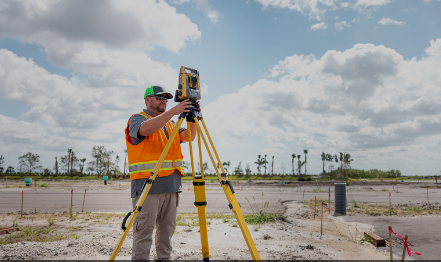
Surveyors are responsible for accurately measuring and mapping the Earth’s surface. Their work is integral to various industries, including construction, real estate, environmental planning, and infrastructure development. Surveyors ensure the precise determination of property boundaries, the layout of construction projects, and the creation of detailed maps.
b. Diverse Specializations
Surveying encompasses various specializations, including land surveying, geodetic surveying, hydrographic surveying, and cadastral surveying. Each specialization addresses specific needs, such as determining property boundaries, mapping the Earth’s shape, surveying bodies of water, and managing land records.
c. Integration of Technology
Advancements in technology have significantly impacted surveying practices. Modern surveyors use sophisticated tools such as GPS, laser scanners, drones, and GIS (Geographic Information System) software to enhance the accuracy and efficiency of their work.
d. Legal and Ethical Considerations
Surveyors often work on projects with legal implications. They must adhere to ethical standards and legal regulations, ensuring that their surveys are accurate, reliable, and compliant with relevant laws and regulations.
Educational Requirements for Surveyors
a. Bachelor’s Degree in Surveying or Related Field
The most common educational path for aspiring surveyors is to obtain a bachelor’s degree in surveying, geomatics, or a related field. These programs cover topics such as geodesy, photogrammetry, land law, and surveying techniques.
b. State Licensing Requirements
Many countries and states have licensing requirements for surveyors. To become a licensed surveyor, individuals typically need to complete a specific number of years of work experience under the supervision of a licensed surveyor and pass a licensing exam.
c. Continuing Education
Surveyors often engage in continuing education to stay updated on the latest technologies, methodologies, and legal requirements in the field. Continuing education is essential for maintaining licensure and staying competitive in the profession.
d. Professional Certifications
In addition to state licensing, surveyors may pursue professional certifications from organizations such as the National Council of Examiners for Engineering and Surveying (NCEES) or the American Institute of Certified Planners (AICP). These certifications demonstrate expertise in specific areas of surveying.
Essential Skills for Surveyors
a. Technical Proficiency
Surveyors must be proficient in using a variety of technical instruments and tools, including total stations, GPS receivers, and laser scanners. Technical expertise is essential for accurate data collection and mapping.
b. Analytical Skills
Analytical skills are crucial for interpreting survey data, identifying patterns, and making informed decisions. Surveyors analyze topographic features, land boundaries, and other spatial data to provide accurate and actionable information.
c. Attention to Detail
Surveying requires a high level of precision, and surveyors must pay meticulous attention to detail. Small errors in measurements or calculations can have significant consequences, making attention to detail paramount.
d. Problem-Solving Abilities
Surveyors encounter various challenges in the field, such as difficult terrain, adverse weather conditions, or equipment malfunctions. Strong problem-solving abilities are essential for overcoming these challenges and ensuring the success of surveying projects.
e. Communication Skills
Effective communication is critical for surveyors to convey information to clients, team members, and other stakeholders. Survey reports, maps, and legal descriptions must be communicated clearly and accurately.
Job Responsibilities of Surveyors
a. Boundary Surveys
Boundary surveys involve determining and marking the legal boundaries of a property. Surveyors use deeds, legal descriptions, and field measurements to accurately establish property lines.
b. Topographic Surveys
Topographic surveys capture the physical features of a specific area, including elevation, contours, and natural or man-made features. These surveys provide valuable information for engineering, construction, and environmental planning projects.
c. Construction Surveys
Construction surveys involve staking out reference points and markers that guide the construction of buildings, roads, bridges, and other infrastructure projects. Surveyors ensure that construction aligns with design plans and specifications.
d. Geodetic Surveys
Geodetic surveys focus on determining the Earth’s shape, size, and gravitational field. Surveyors in this specialization contribute to global positioning systems (GPS) and satellite-based mapping technologies.
e. Cadastral Surveys
Cadastral surveys involve the measurement and delineation of land parcels for legal and administrative purposes. Surveyors create cadastral maps that show property boundaries, ownership, and land use.
Career Prospects for Surveyors
a. Diverse Employment Opportunities
Surveyors can work in various settings, including private surveying firms, government agencies, construction companies, engineering firms, and environmental organizations. The diversity of employment opportunities allows surveyors to choose career paths that align with their interests and expertise.
b. Consulting and Entrepreneurship
Experienced surveyors may choose to start their own surveying businesses or work as independent consultants. Entrepreneurial opportunities exist in providing specialized surveying services, consulting on land development projects, or offering expert witness services in legal cases.
c. Government Positions
Many surveyors find employment in government agencies at the local, state, or federal levels. Government positions may involve regulatory compliance, land management, or infrastructure planning.
d. International Opportunities
Surveyors with global positioning and geodetic expertise may have opportunities to work on international projects. Global organizations and companies engaged in large-scale infrastructure or environmental initiatives often seek skilled surveyors.
Challenges Faced by Surveyors
a. Environmental Challenges
Surveyors often work in challenging environmental conditions, including extreme temperatures, rough terrain, and adverse weather. These conditions can impact the accuracy and safety of surveying activities.
b. Legal Disputes and Litigation
Surveyors may become involved in legal disputes related to property boundaries, land use, or construction issues. Legal challenges require surveyors to provide expert testimony and navigate complex legal proceedings.
c. Technological Advancements
While technology enhances surveying capabilities, it also presents challenges. Surveyors need to continually adapt to evolving technologies, ensuring they remain proficient in the use of advanced instruments and software.
d. Project Management Pressures
Surveying projects often operate on tight schedules and budgets. Surveyors must effectively manage projects, coordinate with other professionals, and ensure that surveying activities align with overall project timelines.
Evolving Landscape of Surveying
a. Digital Transformation in Surveying
The surveying profession is undergoing a digital transformation, with the integration of digital tools and technologies. Surveyors use Geographic Information Systems (GIS), drones, and advanced software for data collection, analysis, and mapping.
b. 3D Laser Scanning and LiDAR
3D laser scanning and LiDAR (Light Detection and Ranging) technologies enable surveyors to capture highly detailed and accurate three-dimensional representations of landscapes, structures, and objects. This enhances the precision and efficiency of surveying projects.
c. Drone Technology
Drones have become valuable tools in surveying, allowing surveyors to capture aerial imagery, conduct topographic surveys, and monitor construction sites. Drone technology improves accessibility to challenging terrains and enhances surveying capabilities.
d. Integration with Building Information Modeling (BIM)
Surveyors increasingly collaborate with professionals in the construction and engineering fields through Building Information Modeling (BIM). This integration improves coordination and communication throughout the entire project lifecycle.
Future Trends in Surveying
a. Artificial Intelligence in Survey Data Analysis
The use of artificial intelligence (AI) in survey data analysis is an emerging trend. AI algorithms can process large datasets, identify patterns, and extract meaningful insights, enhancing the speed and accuracy of survey data interpretation.
b. Blockchain for Land Records
Blockchain technology is being explored for its potential in securely managing land records. Surveyors may become involved in implementing blockchain solutions for transparent and tamper-resistant land registries.
c. Environmental and Climate Monitoring
Surveyors may increasingly contribute to environmental monitoring and climate studies. Spatial data collected by surveyors can be instrumental in assessing environmental changes, monitoring ecosystems, and supporting sustainable land management.
d. Smart Cities and Infrastructure Planning
As cities evolve into smart cities, surveyors will play a vital role in urban planning and infrastructure development. Smart city initiatives leverage spatial data for efficient transportation, energy management, and overall urban design.
Conclusion
Surveyors stand at the intersection of precision, technology, and spatial intelligence, shaping the physical and digital landscapes of our world. Their work is fundamental to the development, planning, and sustainability of our communities. As the surveying profession continues to evolve, surveyors must embrace technological advancements, navigate legal complexities, and contribute to the global transformation of spatial data management. In doing so, they ensure that the maps we follow, the boundaries we respect, and the structures we build are grounded in accuracy and innovation.